Close
responsive-lightbox domain was triggered too early. This is usually an indicator for some code in the plugin or theme running too early. Translations should be loaded at the init action or later. Please see Debugging in WordPress for more information. (This message was added in version 6.7.0.) in /home/kiju52ce/public_html/development/wp-includes/functions.php on line 6114updraftplus domain was triggered too early. This is usually an indicator for some code in the plugin or theme running too early. Translations should be loaded at the init action or later. Please see Debugging in WordPress for more information. (This message was added in version 6.7.0.) in /home/kiju52ce/public_html/development/wp-includes/functions.php on line 6114
Approach Words: Heritage Preservation, Sustainability, Urban Livability
Public Policy Instruments: Physical Intervention, Planning, Regulatory
Muttrah Infrastructure Integration and Redevelopment (MIIR) is a redevelopment project of Muscat’s historic Muttrah district1. The project aims to transform the historic village of Muttrah into a contemporary urban area, while preserving heritage sites to attract tourists and improve urban livability for residents and visitors2. MIIR sets a vision for Mutrah and acts as a guiding plan for sustainable urban development3 in the area through 2050. It focuses on raising the efficiency of health and environmental services, as well as expanding current necessary Services4.
The redevelopment plan has set out the following four main goals:

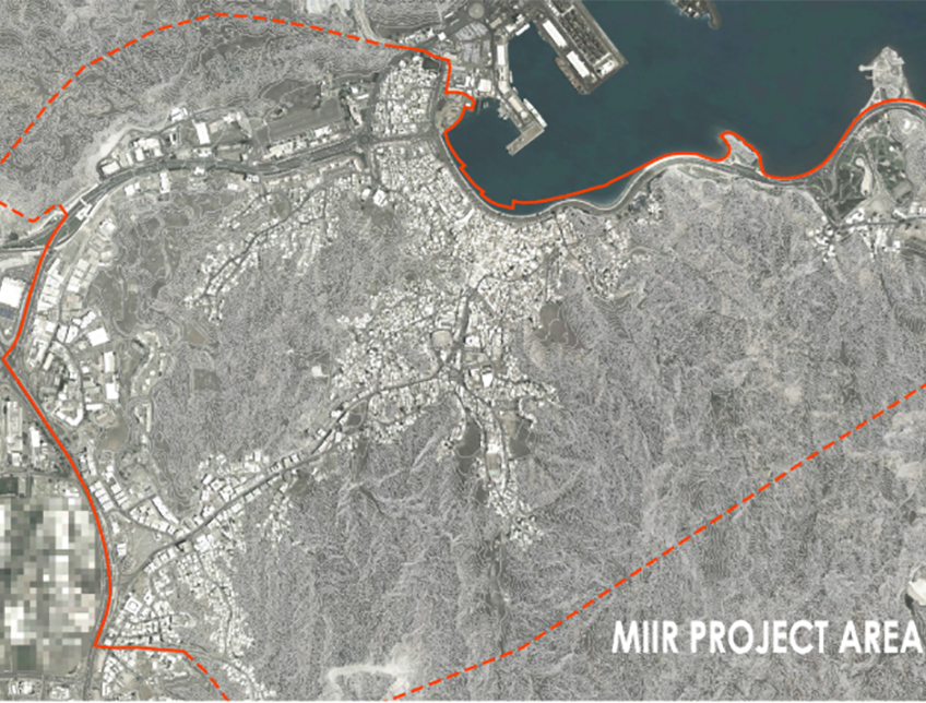
Title: Muttrah Infrastructure Integration and Redevelopment Project Area.
Source: Click Here

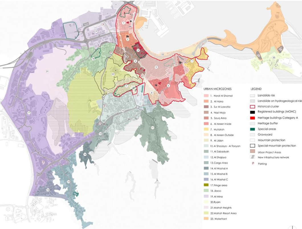
Title: Master Plan of The Muttrah Infrastructure Integration and Redevelopment Project.
Source: Click Here

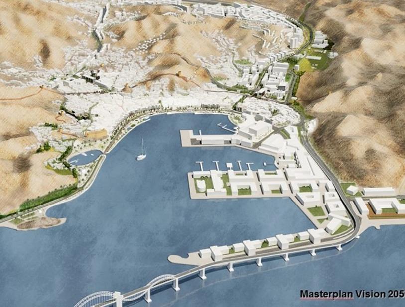
Title: Rendered aerial view of the Muttrah Infrastructure Integration and Redevelopment Project.
Source: Click Here

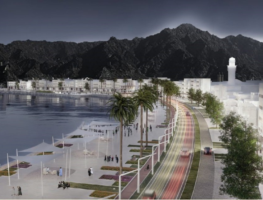
Title: 3D rendering showing the envisioned corniche by night in the Muttrah Infrastructure Integration and Redevelopment Project.
Source: Click Here
To implement the project’s objectives, a master plan5 was proposed which extends along a 4.7 square kilometer at Mutrah in Muscat City6 and includes the areas surrounding Muttrah Souq, the old Muttrah neighborhood that runs from Bait Oman to Souq al Lawatia, and the portion of Riyam Park that ends at the roundabout at Port Sultan Qaboos’ entrance7 8. The master plan area includes the historical center and the market (Souk), the mountainous Skyline, the Fort, the towers and the ancient city wall, the “Corniche”, the new residential areas and historical buildings9. The integrated plan includes multimodal mobility strategy, traffic and parking plan, heritage conservation, public services and facilities plan, tourism and cultural strategies, Matrah smart city strategy, security and safety strategy, public realm strategies, and preliminary project areas10.
The implementation of the plan is incremental11 and involves midterm term targets that are to be achieved by 2025. It includes the improvement of urban services and infrastructure works such as water supply and sewerage systems, wastewater treatment, power supply, a telecommunication system with the introduction of fiber optics, a road lighting system, and fire-fighting and irrigation systems. It also includes providing parking spaces in the area, as well as the creation of public spaces and the widening of some key streets.

Owner/Developer (Public)


The project is initiated by Muscat Municipality12 that has specified a master plan for the project proposed by Sering Ingegneria and Norplan Consulting Engineers and Planners13 14. The master plan will be implemented by Muscat Municipality and Haya Water15 , a government-owned company as the principal contractors responsible for project implementation which set an intermediate target to 2025 where the overall estimated project construction cost is in the region of US$ 1.29 billion16 17.
The project occurred in two main stages:
Project Link
Endnotes
References